Images of Hatfield – New Barnfield and surroundings
This section contains images of New Barnfield and the surrounding countryside that borders Travellers Lane and the A1001 Southway (at the southern end of Hatfield). While the area's postal address is Hatfield, much of the area comes under the North Mimms Parish Council (with road access mainly from Hatfield). Some of the land is owned by the Homes & Communities Agency, other parts are farmland which are not being cultivated. Horses are reared at Parsonage Farm on the Welham Green side.
New Barnfield is the name given to the Hertfordshire County Council property used, at the time of publishing, to house the Central Resources Library (and other library and educational services). Originally, the site was developed as the Hatfield School in 1953. In the mid-Eighties, Southfield School for special needs children was opened next to it. However, the focus here is on the countryside surrounding them. New Barnfield is part of a hill, and on a clear day you can see neighbouring St Albans, Shenley and Welwyn Garden City.
There are several access points from the Hatfield side: by the Tesco end of the Travellers Lane footbridge across Southway (A1001); steps off Southway; by the side of the entrance to Welwyn Hatfield Lawn Cemetery; and steps by the junction of Southway and Bishops Rise.
Please note: access is on foot, the ground can be uneven and muddy after rains. So you are advised to wear appropriate footwear and clothing. There are some marked walks (details on the Hertfordshire County Council website).
Sadly, Hertfordshire County Council (Conservative-control) has decided to use New Barnfield as a site for an industrial incinerator. More information on the incinerator and views of St Albans and Welwyn Garden City (under 'Impact on Hertfordshire'), and of the New Barnfield hill (under 'Impact on Hatfield') is published under 'Hot Topics'.
Click here for more on the incinerator and views...
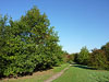
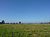
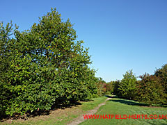
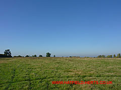
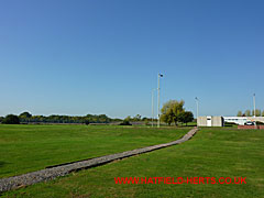
View down the path from the entrance by the footbridge across Southway. Looking towards Travellers Lane.
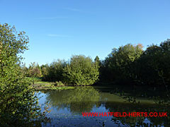
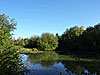
Bunchleys Pond – the biggest of the watercourses. The New Barnfield site is behind the trees to the right.
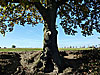
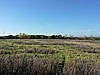
View of the Oak by Bunchleys Pond and the hilltop beyond. Poplars and other trees lining Southway visible to the left,
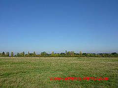
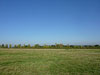
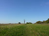
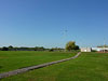
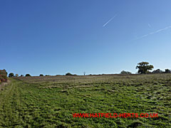
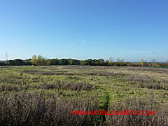
View from the top of the hill facing towards Southway.
View from the hilltop, past Bunchleys Pond, facing west towards St Albans
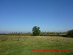
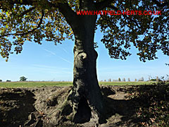
Different view of the Oak tree visible in the middle in the image above. This shot taken looking toward Southway (almost right angled to the image above).
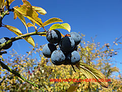
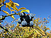
Autumn berries (possibly Privet) on the hedgerows.
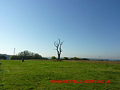
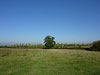
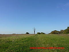
Burnt tree and Ordnance Survey marker (to the left) useful landmarks on the open ground beyond the wooded area behind New Barnfield. Path ahead – on the right – leads to the paddocks, and another route to Welham Green.
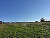
Down the paddock route looking back. Part of the hilltop is wooded and stretches back to New Barnfield.
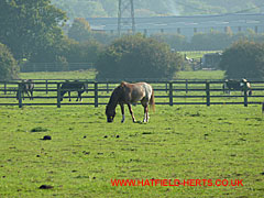
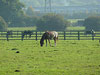
Horses in their paddocks at Parsonage Farm (Welham Green / southern side).
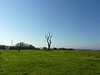
View from the bottom of the hill on the other side. Burnt tree just visible in the centre. Welwyn Hatfield Lawn Cemetery is to the left and behind runs the footpath / old lane, which is accessible using the steps near the junction of Southway and Bishops Rise (as is Angerland Common).
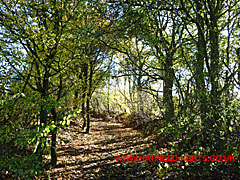
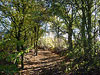
Section of the wooded path (an old farm lane) that runs at the bottom of the hill and around.
View of Angerland Common on the other side of the wooded path. The back of the University Park and Ride car park is on the right. There are plans to build a football stadium on this land.
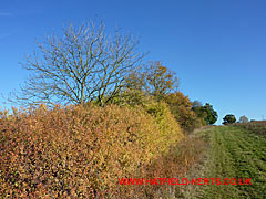
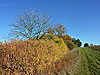
Autumn colours on the hedgerow bordering the Welwyn Hatfield Lawn Cemetery (heading back up the hill).
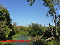
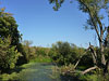
View of Little Bunchleys Pond located in the wooded area at the top of the hill.
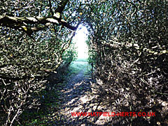
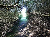
Pathway through the undergrowth from Little Bunchleys Pond to the open hilltop on the Hatfield side (there are more open and comfortable routes).
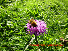
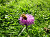
Bumblebee pollinating a flower (possibly Knapweed or Red Clover). More examples of the biodiversity of the site.
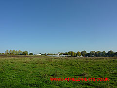
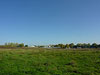
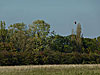
New Barnfield former school site seen from the Welham Green side – looking north, Hatfield town beyond.
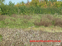
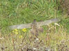
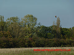
Section of the vegetation on the top of hill behind New Barnfield. The area is a nature habitat for plants, animals and birds – like the one in the centre of the picture (expanded view below).
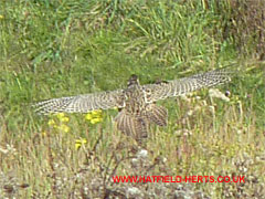
Closer view of bird taking flight – probably a female partridge.
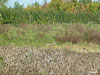
New Barnfield site from the edge of the eastern boundary fence – looking west. The wooded section can be seen to the right.
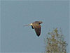
Section of the vegetation and bird of prey in flight (expanded view below).
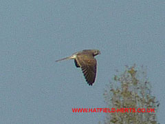
Close up of the bird of prey. Probably a kestrel. Red Kites have also regularly been seen in the area.
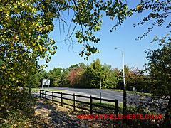
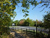
Section of the foot and cycle path that runs along Travellers Lane past the entrance to Southfield School and New Barnfield.
Back to: Hatfield Photo Gallery – Part 3